Maps & Directions
Click on a map to enlarge in a separate window.
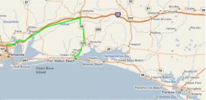
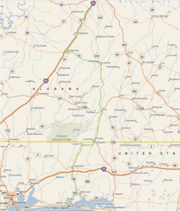
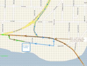
From Pensacola (and points west) via I-10: Follow I-10 east to the Crestview/I-85 Exit. Turn Right onto I-85. Drive south for approximately 12 miles and veer Right at the I-123 Exit. Merge Right onto I-85 at the light and continue south on I-85 past the Armament Museum. Merge Left onto Eglin Parkway. Stay on Eglin Parkway until you get to State Highway 98 (Hwy 98). Be in the right lane when you get to Hwy 98. Turn left on Hwy 98 and go one block to Perry Ave. Turn Right on Perry, go one block and turn Right at the stop sign onto Brooks Street. Follow Brooks Street about two blocks and see the Ft. Walton Landing on the Left side.
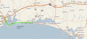
From Pensacola via State Highway 98: Head east on Hwy 98 all the way into Ft. Walton Beach. Turn Right at the light onto Brooks Street (just past the Marina Bay Resort on your left). Follow Brooks Street around for about 2 blocks and the Ft. Walton Landing will be on your Right.
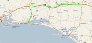
From Points East via I-10: Follow I-10 west to the Crestview/I85 Exit. Turn Left onto I-85. Drive south for approximately 12 miles and veer Right at the I-123 exit. Merge Right onto I-85 at the light and continue south on I-85 past the Armament Museum. Merge Left onto Eglin Parkway. Stay on Eglin Parkway until you get to Hwy 98. Be in the right lane when you get to Hwy 98. Turn Left on Hwy 98 and go one block to Perry Ave. Turn Right on Perry, go one block and turn Right at the stop sign onto Brooks Street. Follow Brooks Street about two blocks and see the Ft. Walton Landing on the Left side.
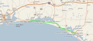
From Panama City via State Highway 98: Head west on Hwy 98 all the way through Okaloosa Island to the Brooks Bridge. Cross over the Brooks Bridge and continue on Hwy 98, turn Left at the light onto Brooks Street (just past the Indian Temple Mound on your right). Follow Brooks Street around for about 2 blocks and the Ft. Walton Landing will be on your Right.
From Montgromery and Points North via I-65: Follow I-65 south to the Greenville Exit. Turn Left onto Hwy 10. Follow Hwy 10 east to Luverne. Turn Right in Luverne onto Hwy 331 to Florala. Turn Right onto Hwy 85 toward Crestview. Drive south for approximately 12 miles from the southern end of Crestview and veer Right at the I-123 Exit. Merge Right onto I-85 at the light and continue south on I-85 past the Armament Museum. Merge Left onto Eglin Parkway. Stay on Eglin Parkway until you get to Hwy 98. Be in the right lane when you get to Hwy 98. Turn Left on Hwy 98 and go one block to Perry Ave. Turn Right on Perry, go one block and turn Right at the stop sign onto Brooks Street. Follow Brooks Street about two blocks and see the Ft. Walton Landing on the Left side.
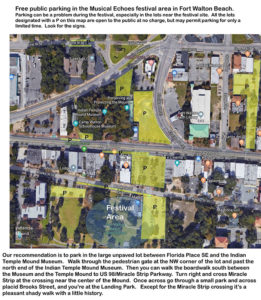
Free public parking in the Musical Echoes festival area in Fort Walton Beach.
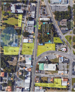
Parking can be a problem during the festival, especially in the lots near the festival site. All the lots designated with a P on this map are open to the public at no charge, but may permit parking for only a limited time. Look for the signs.
Our recommendation is to park in the large unpaved lot between Florida Place SE and the Indian Temple Mound Museum. Walk through the pedestrian gate at the NW corner of the lot and past the north end of the Indian Temple Mound Museum. Then you can walk the boardwalk south between the Museum and the Temple Mound to US 98/Miracle Strip Parkway. Turn right and cross Miracle Strip at the crossing near the center of the Mound. Once across go through a small park and across placid Brooks Street, and you’re at the Landing Park. Except for the Miracle Strip crossing it’s a pleasant shady walk with a little history.


